
Garmin eTrex SE
4.2Editor score
Long battery life
Water-resistant IPX7 rating
Multi-GNSS support
Navigating the open water requires reliable tools to ensure safety and efficiency during every trip. A handheld GPS for boating provides essential positioning data, route planning capabilities, and emergency tracking features that can make a critical difference when you are far from shore or in unfamiliar waters.
We have carefully evaluated ten top-rated marine navigation devices based on their build quality, satellite accuracy, battery performance, and specific boating features. Our analysis focuses on models that offer rugged designs, waterproof ratings, and intuitive interfaces suitable for harsh marine environments and varying weather conditions.
Each selection in this list highlights unique strengths such as preloaded charts, satellite communication, or extended battery life. While ratings and availability may shift over time, these devices represent the current leaders in portable marine navigation technology for both casual boaters and serious sailors.
4.2Editor score

4.0Editor score
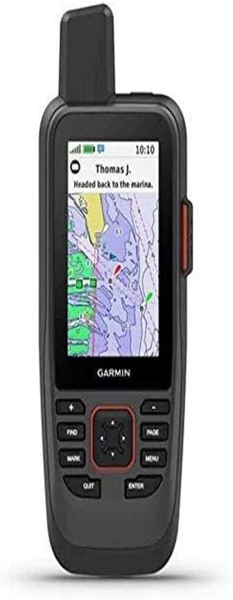
4.2Editor score
As an Amazon Associate we earn from qualifying purchases.
The following comparison table outlines the key specifications and capabilities of each device to help you quickly identify which model fits your specific boating needs and budget requirements.




The Garmin GPSMAP 79sc stands out as a premier handheld GPS for boating due to its comprehensive marine-focused features and rugged construction. It holds a strong rating among users who value reliability on the water. The device comes preloaded with BlueChart g3 coastal charts, providing immediate access to essential navigational data without extra purchases.
We may earn a commission when you buy through this link, at no additional cost to you.
Its design is specifically tailored for marine environments, featuring a floating casing that prevents loss if it slips overboard. The high-resolution color display remains visible even under bright sunlight, ensuring you can read critical information like depth and waypoints clearly. Additionally, support for multiple satellite constellations ensures consistent tracking accuracy across different regions.
While the unit itself is water-resistant, users should note that the rating applies to the device body and not necessarily ports or accessories. The battery life offers a reliable window for day trips, though carrying spares is wise for longer expeditions. These minor trade-offs are acceptable given the robust feature set aimed at safety and navigation.
Boaters seeking a reliable all-in-one solution will find this device highly beneficial for coastal cruising and fishing trips. Its combination of preloaded maps, floatation capability, and durable build makes it a top recommendation for anyone prioritizing safety and ease of use on the water.
The inclusion of BlueChart g3 charts means you can start navigating immediately upon unboxing, saving time and money on map purchases.
Its ability to float ensures that accidental drops into the water do not result in permanent loss of your navigation device.
We may earn a commission when you buy through this link, at no additional cost to you.
The Garmin GPSMAP 79s is an excellent choice for boaters who travel frequently to different regions or international waters. It shares many core features with the 79sc but substitutes detailed coastal charts with a worldwide basemap. This makes it ideal for those who prefer to download specific maps based on their current location rather than carrying preloaded regional data.
We may earn a commission when you buy through this link, at no additional cost to you.
Its rugged design ensures it can withstand the bumps and splashes common on a boat. The floating feature adds an extra layer of security, preventing loss during active use. The display is sharp and easy to read, providing clear visual feedback for position and speed data. Battery performance is consistent, offering ample power for typical day trips.
Users may need to purchase additional coastal map updates if they require detailed nautical data for specific harbors. The water resistance is reliable for the device itself but does not cover ports fully. Despite these considerations, the global coverage and durability make it a strong contender for versatile navigation needs.
This device is best suited for adventurous boaters who value global reach and durability over preloaded specific regional charts. It provides a solid foundation for navigation that can be customized with additional map data as needed for specific voyages.
With a worldwide basemap included, you are prepared to navigate in any ocean without needing to buy region-specific maps immediately.
The unit is engineered to float securely, ensuring you can retrieve it easily if it falls into the water during rough conditions.
We may earn a commission when you buy through this link, at no additional cost to you.
The Garmin eTrex 22x is a versatile navigator often used by hikers but also suitable for boaters who need reliable tracking on water and land. It features a sunlight-readable color display and supports multiple satellite systems for better accuracy. The internal memory allows for storing additional maps via a micro SD card slot, offering flexibility for various travel plans.
We may earn a commission when you buy through this link, at no additional cost to you.
Battery life is a standout feature, with the device capable of running up to twenty-five hours on standard AA batteries. This makes it ideal for long day trips where recharging options are limited. The rugged build ensures it can handle rough conditions, though it lacks specific marine features like floating or water-resistant seals found in dedicated models.
While it does not come with preloaded marine charts, it is capable of displaying generic coordinate data and tracks effectively. Users should be cautious about exposure to heavy water spray given its general-purpose design. However, for casual boating and outdoor activities, it provides robust performance at a competitive price point.
This unit is recommended for outdoor enthusiasts who need one device for both land and water exploration. Its reliability and battery efficiency make it a practical tool for tracking routes and positions during extended outings away from power sources.
With up to twenty-five hours of battery life, you can rely on this device for long days on the water without needing extra batteries.
The micro SD card slot allows you to load additional map data to customize your navigation experience for specific regions.
We may earn a commission when you buy through this link, at no additional cost to you.
The Garmin GPSMAP 86Sci represents the high end of handheld GPS for boating, offering advanced safety features like satellite communication. This device allows users to send text messages and share locations via the Iridium network, which is critical for offshore trips without cellular coverage. It also supports streaming data from compatible chartplotters to consolidate navigation information.
We may earn a commission when you buy through this link, at no additional cost to you.
Its build quality is designed for marine use, featuring a floating, water-resistant design that withstands splashes and accidental drops. The preloaded BlueChart G3 coastal charts ensure you have essential navigational data ready from the start. The 3-inch display is sunlight-visible, making it easy to read even in harsh glare on the water.
While the satellite subscription adds to the ongoing cost, the safety benefits of being able to call for help remotely are invaluable. The device is slightly more expensive than standard navigators, but the integrated communication tools justify the investment for serious sailors. Users should ensure they understand the subscription terms before purchase.
This model is ideal for boaters who prioritize safety and advanced connectivity features. It offers a complete navigation and communication solution that can potentially save lives in emergency situations while keeping you connected to shore regardless of location.
The inreach capability allows you to stay in touch with loved ones or emergency services even when out of cellular range.
Stream data from other instruments to view speed and depth on one screen, simplifying your dashboard setup on the boat.
We may earn a commission when you buy through this link, at no additional cost to you.
The Garmin GPS 73 is specifically tailored for sailors who need specialized navigation tools like virtual starting lines and tack assist. It features a simple user interface with dedicated backlit buttons, making it easy to operate even in low light or when wearing gloves. The device offers core marine features including route planning and alarm settings for anchor drag.
We may earn a commission when you buy through this link, at no additional cost to you.
With a battery life of over eighteen hours, it is reliable for full day sailing excursions. The screen size is adequate for viewing basic position data, and the memory stores sufficient waypoints for typical coastal trips. Its focus on sailing functionality makes it a practical choice for those who do not require advanced map plotting capabilities.
While the design is older, it remains a sturdy tool for essential navigation. Users might find the storage capacity limited compared to modern high-end units, but for basic waypoint tracking, it performs well. The simplicity of the interface reduces the learning curve for new boat owners.
This device is best for sailors looking for a straightforward tool with dedicated aids for racing and navigation. It prioritizes ease of use and essential marine alerts over complex map features, making it a strong tool for functional tracking on the water.
Features like virtual starting lines and speed history help racers optimize their performance and track progress during competitions.
Alerts for off-course deviations and anchor drag provide added security to ensure you are aware of critical changes in your position.
We may earn a commission when you buy through this link, at no additional cost to you.
The Renewed version of the Garmin GPSMAP 79sc offers access to a top-tier marine GPS at a more accessible price point. It retains all the critical features of the new model, including BlueChart g3 charts and a rugged floating design. This option is ideal for budget-conscious boaters who still require high reliability and specific marine tools.
We may earn a commission when you buy through this link, at no additional cost to you.
Buyers can expect a device that has been tested to function properly, ensuring performance standards are met. The high user ratings indicate satisfaction with the quality and durability of these refurbished units. The color display and multiple satellite support work just as effectively as in the brand new version.
While the physical condition might show minor signs of previous use, this does not impact functionality. Warranty terms may be shorter than those for new devices, so checking the return policy is advisable. For many, the cost savings make this a logical choice for acquiring a premium navigational tool.
This product is best for those who want premium marine navigation features without paying full retail price. It provides a practical balance of cost and performance, ensuring you have a reliable tool for safe boating regardless of the purchase status.
You gain access to high-end marine mapping and rugged design at a price that fits tighter budgets without sacrificing functionality.
High user ratings suggest that the renewed units perform reliably, giving confidence in their durability and accuracy on the water.
We may earn a commission when you buy through this link, at no additional cost to you.
The Garmin GPSMAP 65 utilizes multi-band technology to deliver superior positioning accuracy, even in challenging environments like deep canyons or dense forests. While it is often marketed for hiking, its precision makes it useful for boaters who need exact location data. The large 2.6-inch display provides clear visibility of your track and position without squinting.
We may earn a commission when you buy through this link, at no additional cost to you.
Its expanded support for global satellite systems ensures you maintain a connection to multiple networks, enhancing reliability. The button-operated design allows for easy control while wearing gloves or in wet conditions. You can easily manage tracks and waypoints through the Garmin Explore app on a smartphone, adding a layer of modern connectivity.
The device lacks preloaded marine charts but focuses on TopoActive maps which are better suited for land travel. Users intending to use it strictly for navigation coordinates will find it exceptional. However, those needing detailed nautical data may need to add maps separately. The battery performance remains robust for long duration trips.
This unit is a strong choice for technical users who prioritize pinpoint accuracy and multi-band signal reliability. It is a versatile tool that bridges the gap between outdoor hiking gear and precise navigation, offering robust performance for demanding conditions.
Multi-band technology filters out signal interference, providing highly accurate location tracking even in difficult environments.
Syncing with the Garmin Explore app allows you to plan routes and view statistics seamlessly across devices.
We may earn a commission when you buy through this link, at no additional cost to you.
The Garmin eTrex 32x is designed for endurance, offering up to twenty-five hours of battery life on standard AA batteries. This makes it a reliable companion for long trips where power sources are scarce. It includes a 3-axis compass and barometric altimeter, providing valuable orientation data in addition to GPS coordinates.
We may earn a commission when you buy through this link, at no additional cost to you.
Its internal memory and micro SD card slot allow for extensive map storage, giving users the flexibility to carry multiple map regions. The sunlight-readable color display ensures visibility under direct sun, which is a common challenge on open water. The rugged construction withstands shocks and moisture to a reasonable degree.
While it lacks specific marine alarms or floating capabilities, its tracking accuracy is sufficient for general navigation. The added weight due to extra sensors might be a consideration for some, but the utility it provides is significant. It is a solid tool for general tracking and outdoor adventure.
This model is best for those who need long-lasting power and detailed environmental data like altitude and heading. It balances durability with advanced sensor capabilities, making it a versatile choice for outdoor tracking and basic navigation tasks.
The ability to run for up to twenty-five hours ensures you stay navigated throughout long days without needing to swap batteries.
A barometric altimeter and 3-axis compass provide essential orientation data beyond basic GPS location tracking.
We may earn a commission when you buy through this link, at no additional cost to you.
The Garmin eTrex SE is notable for its exceptional battery life, reaching up to 168 hours in standard mode. This makes it an ideal choice for multi-day adventures where charging is impossible. It features a water-resistant design rated to IPX7, meaning it can be submerged temporarily, which is helpful for wet marine environments.
We may earn a commission when you buy through this link, at no additional cost to you.
Its high-resolution display is easy to read in sunlight, ensuring clear visibility of your current position and heading. The device pairs with the Garmin Explore app for software updates and trip planning, adding a layer of modern convenience. Multi-GNSS support ensures you stay connected to multiple satellite networks for reliable tracking.
While it does not offer advanced marine-specific features like charts, its simplicity and battery endurance make it a great backup or secondary navigator. The lightweight design ensures it does not add bulk to your gear. It is a practical tool for those who prioritize reliability over complex map features.
This unit is best suited for users needing a dependable tracker with minimal power consumption. It serves well as a reliable companion for safety and basic location tracking over extended periods without needing frequent battery changes.
With up to 168 hours of battery life, this device is perfect for multi-day trips where power is not accessible.
An IPX7 rating allows the device to withstand accidental submersion, providing confidence in unpredictable weather.
We may earn a commission when you buy through this link, at no additional cost to you.
The Garmin GPS 76 is a classic model that offers basic navigation capabilities at an affordable price point. It features WAAS enabled tracking, which improves accuracy by correcting GPS signal errors. This makes it a decent option for casual users who need straightforward position tracking without complex map layers.
We may earn a commission when you buy through this link, at no additional cost to you.
Its trip computer provides data on speed and distance, which can be useful for casual outings. The interface is simple, ensuring you can operate it quickly without getting lost in menus. Battery life is adequate for standard day trips, powered by standard AA batteries for easy replacement.
The device lacks modern features like color screens or extensive map storage, making it a basic tool for coordinate tracking. It is best used as a supplementary device or for those who prefer simplicity over advanced functionality. While outdated, it still serves the core purpose of navigation.
This model is ideal for those who need a reliable, no-frills GPS for basic tracking. It offers a practical solution for users who do not require detailed charts or advanced connectivity, focusing purely on getting from point A to point B.
WAAS technology enhances signal precision, ensuring you stay on course with minimal deviation in your tracked path.
Basic trip computer features give you immediate feedback on speed and distance traveled during your journey.
We may earn a commission when you buy through this link, at no additional cost to you.
Selecting the right handheld GPS for boating involves evaluating several key factors to ensure safety and reliability on the water.
A handheld GPS for boating should ideally be waterproof and capable of floating if dropped. Look for devices with IPX7 or higher ratings to ensure protection against water ingress. A floating design is critical because losing a navigation device overboard can compromise your ability to navigate safely back to shore.
Prioritize models that are certified to float and resist water damage to avoid unnecessary replacements or loss during active use on the boat.
Battery performance is vital for long days on the water. Devices with AA batteries offer the convenience of easy replacements in the field. Aim for a battery life of at least 18 to 25 hours to cover typical excursions without needing to recharge or swap batteries frequently.
Check for battery indicators that give accurate warnings so you can prepare backups before the power runs out during a trip.
Having preloaded maps reduces the need for extra purchases. BlueChart g3 charts are specifically designed for marine navigation and provide depth data and shoreline details. A device with good map support ensures you can navigate without relying solely on coordinates.
Ensure the device allows for easy map updates or downloads to keep navigational data current for the regions you frequent most often.
Modern GPS devices support multiple satellite constellations like GPS, GLONASS, and Galileo. This multi-GNSS support improves tracking accuracy especially in challenging environments like near shorelines or open water. Look for models with WAAS or multi-band technology for enhanced precision.
Higher accuracy ensures you can pinpoint your location more reliably which is essential for avoiding hazards and staying on course safely.
The screen should be sunlight-readable to remain visible even under direct glare. A color display helps distinguish map elements clearly. Buttons should be large enough to operate with gloves, and the menu system should be intuitive to avoid confusion while navigating.
A good interface allows you to focus on the water rather than the device, enhancing overall safety during operation.
Look for features like Man Overboard (MOB) alarms or satellite communication capabilities. These can be lifesaving in emergencies when help is far away. Some devices allow you to trigger SOS signals or share your location with family and friends.
Safety features add value by providing an extra layer of protection that might be needed during serious boating expeditions or solo trips.
Expandable memory via SD card slots lets you load more map data for different regions. Connectivity to smartphones allows for updates and trip planning without a computer. Some models can stream data from other boat instruments to consolidate information on one device.
These features increase the versatility of the device ensuring it remains useful as your boating needs evolve over time.
The device must withstand bumps and vibrations common on a boat. Rugged designs with reinforced corners and scratch-resistant glass ensure longevity. Look for models tested against marine environments for durability and resistance to salt spray.
Investing in a well-built unit saves money in the long run by reducing the risk of damage from harsh marine conditions.
Before heading out, charge the battery or insert fresh AA cells and allow the device to acquire satellite signals in a clear area. This initial setup ensures you start with an accurate lock on your position. Check that the device is properly sealed if it is waterproof to prevent any water entry.
During your trip, keep the GPS mounted or within easy reach for regular position checks. Use the waypoint features to mark key locations like fishing spots or hazards. If your device has an alarm feature, set it for anchor drag or off-course alerts to enhance safety.
After use, rinse the device with fresh water to remove salt residue and wipe it dry before storing. Store it in a cool dry place away from direct sunlight to protect the screen and battery. Regularly update the map software via the manufacturer's website to ensure accuracy and performance.
Basic navigation functions like tracking and waypoints do not require a subscription. However, features like satellite messaging or detailed chart updates may need a monthly plan. Check your specific device capabilities before purchasing a subscription plan.
Ideally, it should have an IPX7 or IPX6 rating to withstand splashes or accidental submersion. A floating design is also highly recommended to prevent loss. Ensure all ports are sealed properly before exposing the device to water.
Yes, most models designed for boating use AA batteries which can be replaced easily. This ensures you can extend the life of the device without needing an electrical outlet. Carry spare batteries for trips longer than the battery life rating.
Marine GPS devices often include preloaded charts, floating design, and waterproof ratings. Standard GPS units may lack these specific features. For boating, a marine GPS is preferred for safety and ease of use on the water.
Update maps at least once a year or when moving to new waters. Coastal data changes frequently due to construction or natural events. Regular updates ensure you have the most accurate depth and hazard information.
Multi-GNSS devices support multiple satellite systems to improve tracking in weak areas. However, signal availability depends on the satellite network. Always have a backup navigation method like a compass when in remote locations.
It is safer to store the device in a protective case when not in use. Exposure to sun and salt can damage components over time. Use a mount that secures it but allows removal for safe storage.
The Garmin GPSMAP 79sc stands out as a top choice for most boaters due to its preloaded charts and floating design. It balances performance with essential safety features that make navigating the open water more secure and efficient.
When choosing a device, prioritize waterproofing and battery life over extra features that may not be necessary for your specific needs. A reliable unit will ensure you can track your position accurately and return safely to your starting point every time.
Remember to check current availability and updates from the manufacturer before making a final decision. Technology evolves quickly so verifying compatibility and support for your region is key to a successful purchase.